Day 5.
August 25th, 2021.
The ride for today was one of the most anticipated of this trip.
After having done so much research and having viewed many videos that proliferate the “Youtube” platform, I was finally going to ride the famed Beartooth Highway over the Beartooth Pass that straddles the states of Montana and Wyoming.
Needless to mention I was terribly excited to finally being here for the experience, feeling that I was somewhat familiar with it (because of all the research work I had done).
On the Wyoming side it attains 3,155 m (10,350 feet) and climbs to its summit at an elevation of 3,336 m (10,947 feet) in Montana.
Designated as US Highway 212, it is about (68 miles) long and is an All-American Road which means it is one of the most beautiful roads in America.
Over breakfast, I struck up conversation which lasted about an hour with a fellow motorcyclist who was on his very first road trip ever, heading south back to Texas.
His excitement was contagious and I could tell he was having the trip of his lifetime!
He earned my respect.
He had found the “courage to lose sight of his land in order to cross his ocean”!
Believe me, I know the feeling.
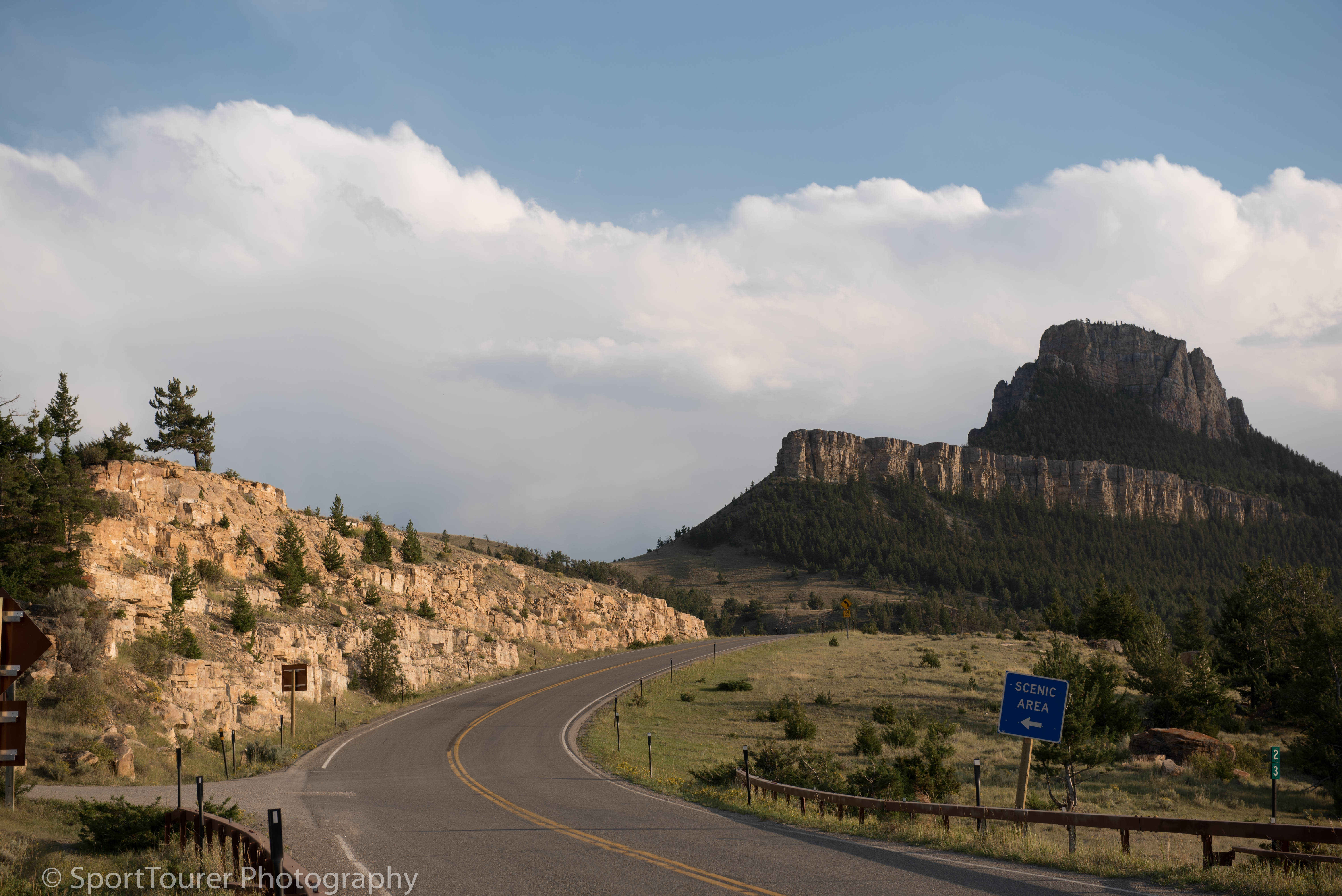
I pulled out of the parking lot close to 8:00 a.m. local time and headed north along Interstate 90, catching exit 9 towards Ranchester, WY where I put myself onto Highway 14 again which took me towards and into the Big Horn National Forest.
The twists and turns of this mountain road thrilled me greatly.
This is the kind of road I had travelled this distance from home to come and experience and enjoy.
I turned off into the Crystal Creek Overlook and met a group of other riders taking in the sights and a break as well.
We struck up conversation and started new friendships over the next half hour.
Beginning to know a little bit about each other, we posed for a group photograph at my request, which ended up becoming quite a few more photos.
We parted ways when they moved on and I was left enjoying the whole expanse by myself
The view of the Big Horn Basin from this overlook was simply breathtaking!
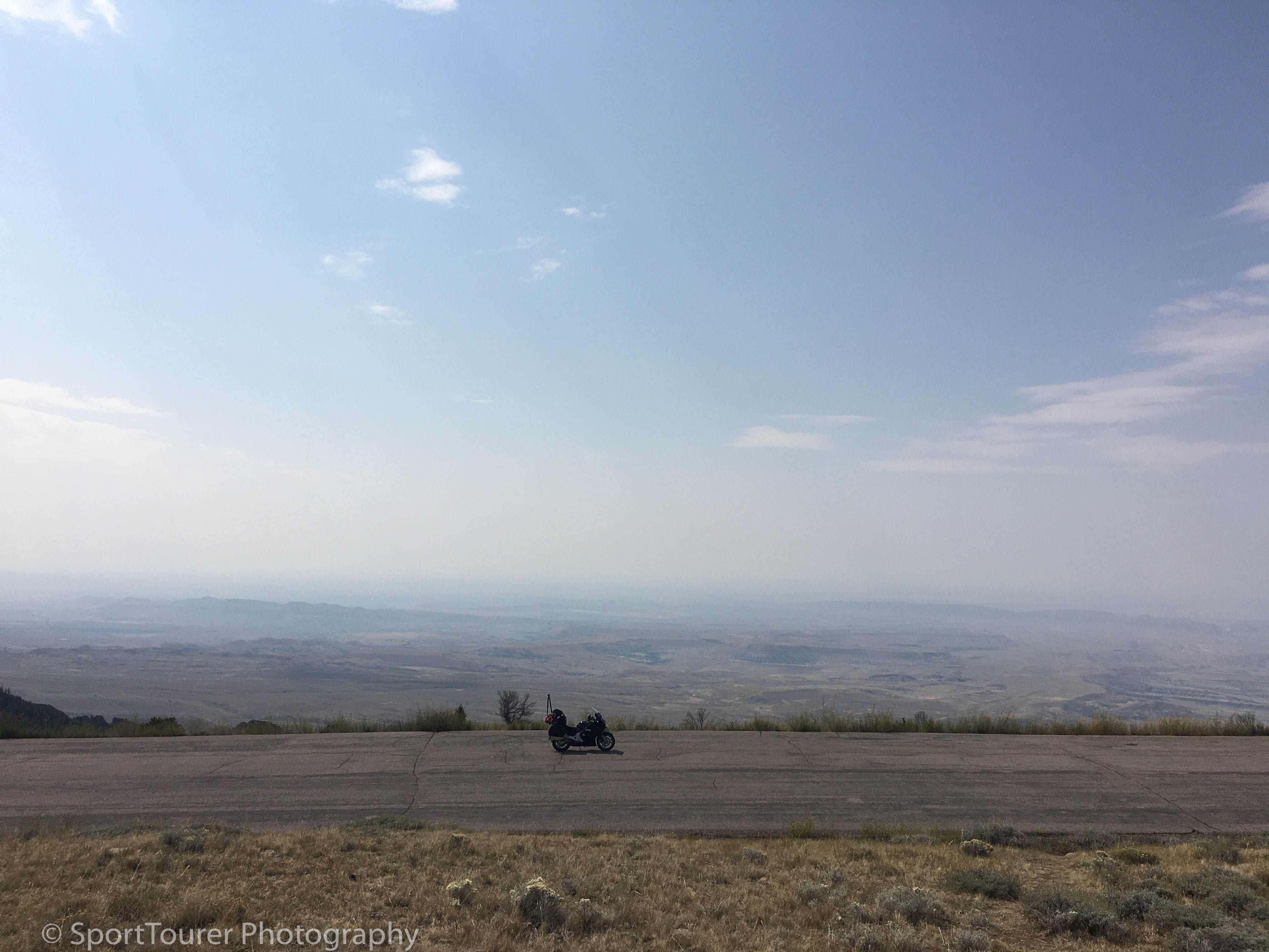
Dropping out of the mountains into the basin, I turned northward onto highway 310 blasting my way through the little towns of Cowley and Deaver.
With speed limits of 80 m.p.h. I was more than glad to settle in for a high speed, relaxing, mile-munching ride.
The ST did “her thing” without a fuss as we crossed back again into Montana!
Hanging a left at the junction of 212, I pulled up in Joliet, MT for a rest/rehydration stop.
A brother/sister couple sauntered over to me and we spent the next half hour making friendly talk after which I pulled out onto the 212 and began my greatly anticipated ride/road of the trip.
The road snaked its way around the Beartooth Mountain with drop-offs the likes of which I had never before encountered and seemed to be climbing forever!
I found myself riding in the opposing lane of traffic flow doing probably no more than 10 to 15 m.p.h.!
I had a death grip on the handlebars!
I didn’t dare let my eyes stray off the road lane, nor could I bear to look out towards the mountains beyond.
I had no doubt that the scenery was breathtaking!
After what seemed like forever, I made it to the Rock Creek Vista Point which stood at 2,801m (9,190 ft).
The view was just out of this world.
I was very lucky though, because up to this point I had not encountered any of the notorious high altitude wind gusts that this road is known for.
It had been a very apprehensive ride to this point, to say the least.
In a few short minutes, less than 10 I’d say, it started to drizzle and within a couple of minutes the place emptied of all visitors.
Everyone left before I could blink 10 times!
“Heck I’d better get a move on too”, I said to myself.
The road continued to wrap around the mountain as it continued to ascend the steep gradient.
Saying I was nervous and almost paralyzed with fear is a serious understatement!
Something kept pushing me on though and after several more hairpin turns, I attained the summit of Beartooth Mountain.
I could now go home and check the box on my bucket list.
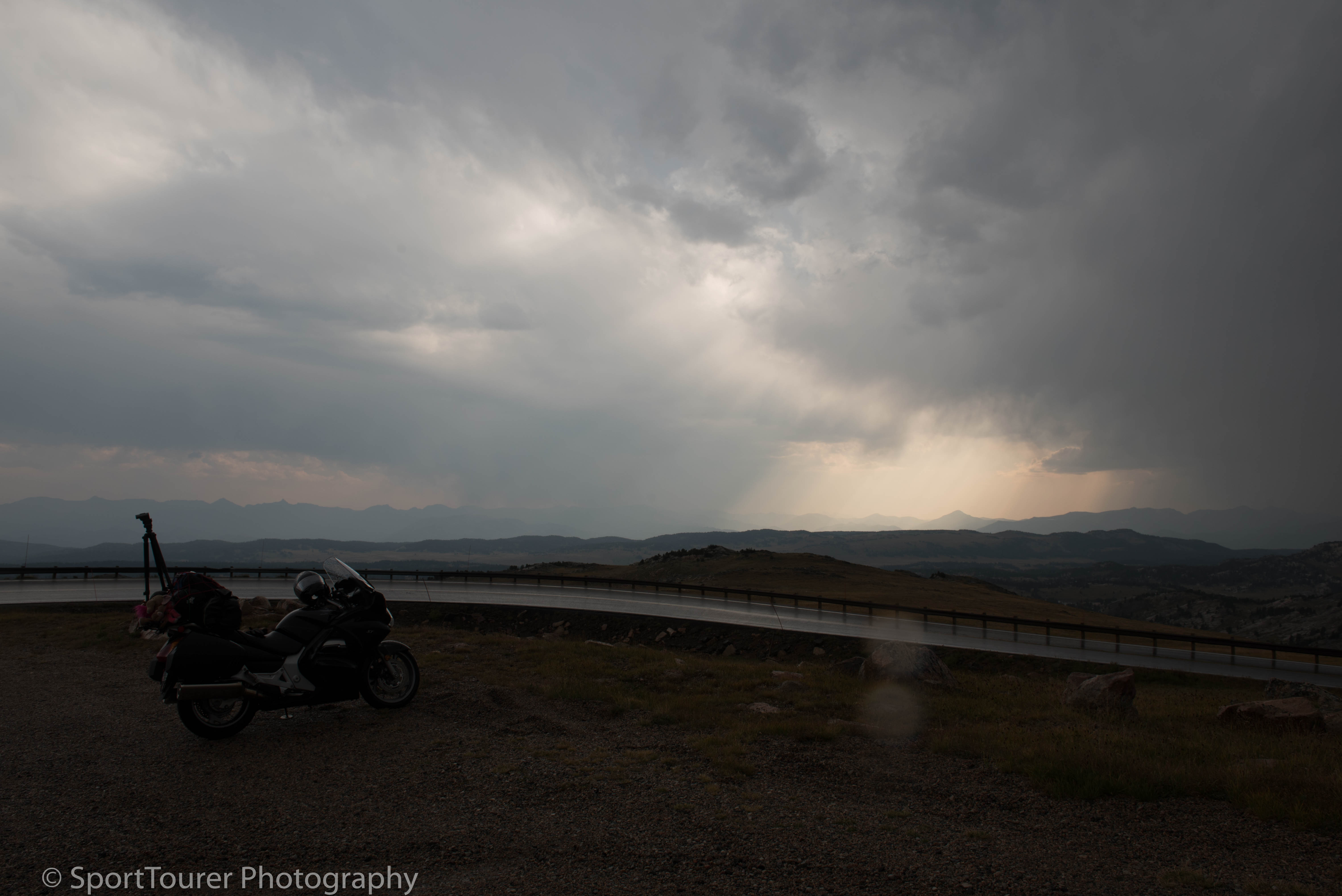
Within 5 minutes of arriving here, as I took some photos, the wind picked up ferociously!
It began to drizzle and then turned heavier into rain, then into freezing rain as the temperature dropped drastically and rapidly!
Hail began to rain down and then shortly afterward began to melt on the ground.
The wind intensity increased and temperatures plummeted even further, turning the road surface into an ice skating rink.
My hands literally began to freeze as I tried to make a video and I had no choice but to stop and begin reaching for my cold weather gear from my luggage.
It felt like being in Cleveland, OH in the middle of a cold winter’s day!
Looking around, everyone had “vamoosed” already.
I was the only one left at the summit and decided that this was no place to be by myself at a time like this under these conditions.
All this occurring in less than 10 minutes!
Now suited up and ready for the elements, I very carefully kept the bike slow and steady on the slick road surface as I motored away from the summit and began the descent.
After a couple of hairpins ice turned to water (much to my joy), with only a slight drizzle.
Way off in the distance I could see rays of sunshine streaking through the clouds and striking the mountain range on the horizon.
Pulling over, I fired off a few photos, stripped my cold weather gear and prepared for the ride down the west side of the mountain.
With my renewed sense of confidence gained from the experience of the ride up the mountain, I enjoyed a very spirited ride all the way to the junction of Highway 296.
Here I met a trio of friends going in the same direction as I was, here at the start of this highway known as the Chief Joseph Scenic Byway a.k.a. Dead Indian Hill Road.
Making new acquaintances we agreed to ride together along this gem of a road.
SPECTACULAR BEAUTY and EXCELLENT ROAD SURFACE - is all I have to say about this road.
I will not hesitate to ride this road ever again!
I enjoyed it more than I did the Beartooth Highway!
We stopped for a few photo ops at Sunlight Bridge (which crosses the Clarks Fork River) and Dead Indian Summit overlook to take in the sights and experience the area and learn a little bit about its history from the interpretive signs placed here.
The Clarks Fork of the Yellowstone was named after Captain William Clark of the Lewis and Clark Expedition.
It was down this river that Chief Joseph led his band of Nez Perce Indians when he made his famous retreat in the summer of 1877.
The late afternoon sun created natural colors on the landscape which made it just that much more captivating.
We motored on and just after 7:30 p.m. we arrived in Cody, WY, gassed up our bikes and parted ways.
I found a hotel in the town center and a steak dinner from a nearby restaurant and settled down for the night after what had turned out to be one of the really notable highlights of my riding life!
So with phone calls returned to my loved ones after a day of no cell phone service/coverage on the day’s ride/roads, I settled down, downloaded and revised my photos and videos of the day.
I was very anxious to view them all and re-live the events and moments of the day again.
I was tired enough to the point where the noisy air conditioner in the room did not even keep me awake nor affect my sleep that night.
I was that tired.
Tired with pleasure.
Definitely an unforgettable, wonderful experience.
Truly a gem of a road with scenery to match.